Transparency and accuracy in designating logging sites: SFE “Forests of Ukraine” has announced a procurement of GNSS receivers
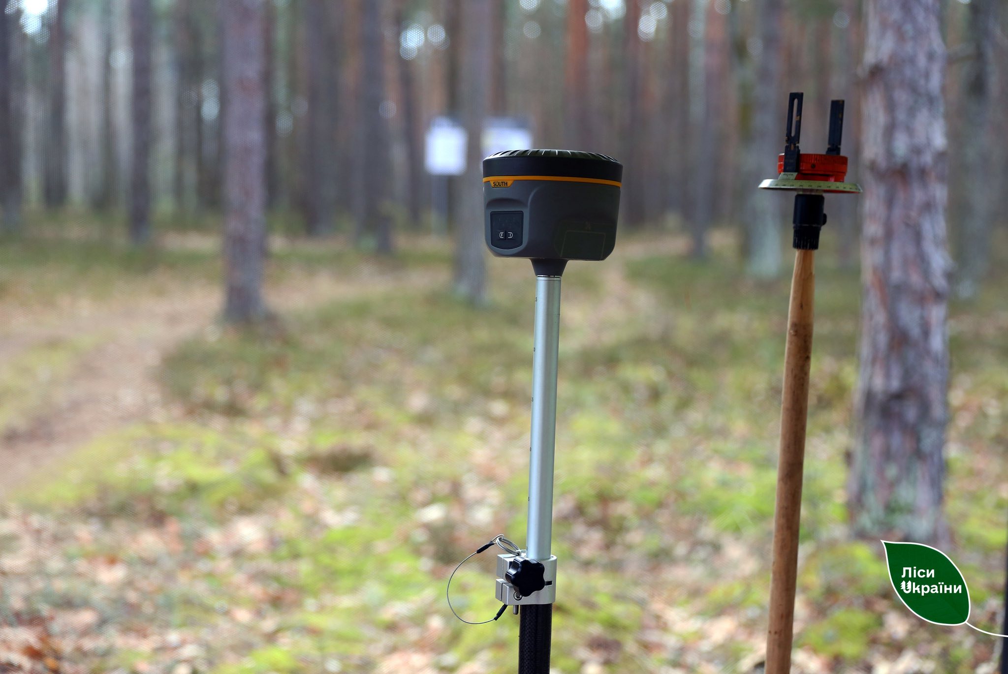
In European forestry companies, digital instruments are used to precisely record the coordinates of harvest sites scheduled for harvesting. The key difference from analogue devices is the rapid, highly accurate delineation of work boundaries (to within a few centimetres) for harvest-site layout and timber-cruising crews.
In particular, a GNSS receiver picks up signals from multiple satellites. Based on these signals, it calculates the coordinates of the point where the receiver is located. The more satellites the receiver “sees” and the better the signal quality, the higher the accuracy.
At present, SFE “Forests of Ukraine” forestry management units have around 90 GNSS receivers, which does not fully cover the needs of the field crews responsible for harvest-site layout.
In some forestry management units, obsolete instruments – bussoles (survey compasses) – are still used when designating sites for felling. All data are recorded by hand on paper, which in turn introduces additional risks when measuring the site.
Therefore, last week SFE “Forests of Ukraine” announced two tenders to procure 134 GNSS receivers. This is the first centralised purchase of such devices.
The GNSS receivers will be adapted to operate in challenging field conditions. They run on the Trimble platform, providing accuracy of up to 2 cm and not requiring ground base stations for differential corrections. These receivers are being procured for the Karpatskyi, Pivnichnyi, Podilskyi, Poliskyi, and Tsentralnyi Forest Offices.
41 GNSS receivers are being procured for the Pivdennyi, Slobozhanskyi, Skhidnyi, and Stolychnyi Forest Offices. They will use a network of ground base stations that provide differential corrections to the satellite data.
What additional advantages do GNSS receivers provide?
Automated record-keeping. All data appear immediately in digital form and can be uploaded right away.
Convenient visualization. The site can be viewed on screen instantly, with support for online maps. The operator can define the survey boundaries.
Eliminating human error. Most measurements and coordinate capture are performed automatically rather than manually.
All data will be synchronised with internal record-keeping systems. The new equipment will ensure greater process transparency, enhance control, and save staff time.